
9ish miles on the cool El Dorado Trail
Monday, August 8th
Although this is a cool August, it still gets warm enough midday to make cycling unpleasant. So we hit the trail at 6:30am, just when the sun was coming over the hills. We also did not want to take a super long time on the ride, but we wanted a workout, so we started at the Mosquito Rd. section of the trail and took it up to the end of the paved section and back down again.
It was pretty slow on the way up, and pretty fast on the way down. These pedestrians were moving along at a good clip, so I had the chance to take several pictures of them, several minutes apart.
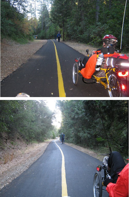
Eventually, they left the trail so we were spared the humiliation of not catching up. Ever.
I did a bunch of checking and tightening and generally playing with my bike between Saturday's ride and today's. I lubed the chain, checked for gobs of stuff in the rear derailluer (none, T-9 lube working great), tightened up my bell's mount, tightened up the front reflector screw, checked the tires for stuff stuck to them, pinged each spoke to see if any were excessively loose, and other such-like geeky things.
I had been noticing for the last couple hundred miles that certain front/rear chainring combinations gave me a little tap on my butt when shifting. It finally occurred to me to try tightening up the seat mesh. Actually, I first thought of the area where my shoulders rest, since I noticed that that area was quite looser than the rest and the ride was not as splendid as it used to be.
While applying vise grips (tm) to the ends of the straps (I'm apparently losing my grip, so I rely on mechanical advantage sometimes) I thought I'd just do all the straps.
I'd go out to the garage and count the straps for you but there are at least 6 that I can think of.
What a difference that made! No more love taps, and my neck felt better after this ride than it has in a while since it was obvious my shoulders were being better supported.
Yay!
I used the GPS Tracks app on my phone again. Worked OK this time.

I also found out I can produce an image of the elevation profile from ridewithgps (I hope it is not slopping over too much on to the sidebar of my blog in your browser).
The wiggly line is the speed, and the red blob is the shallow but unending hill. You can see a peak about mile 3 where we sped down the other side of the freeway overpass, and after our turn around point, those dips in our speed were from braking to check for cross traffic at intersections. Just after mile 7 was a stop for some not too awful port-a-potties.
If you choose to use the playback on the map link, I'd set the speed at about 150% or you'll fall asleep watching us climb the grade. Here's the map.
Riding again on Thursday, then a looooong Saturday ride. Stay tuned!
No comments:
Post a Comment